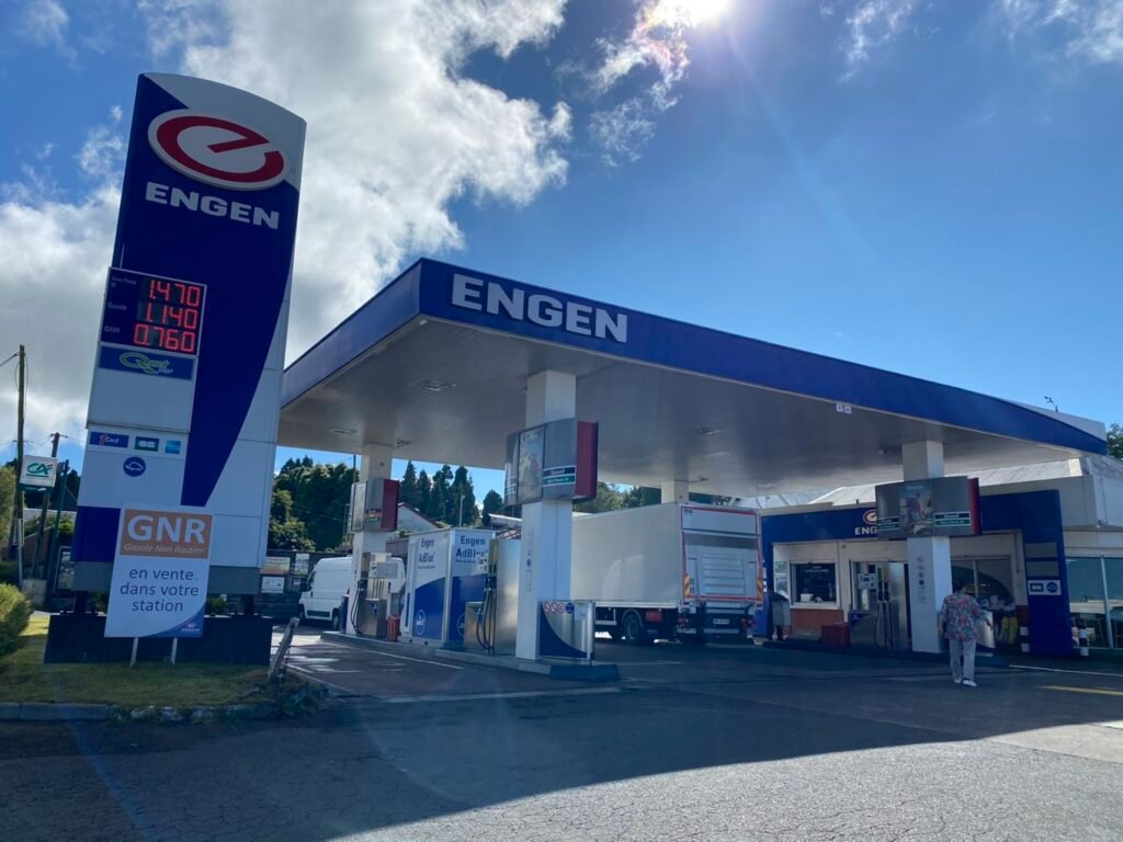
Before heading to Piton de la Fournaise, there’s a gas station, a supermarket, and restrooms available. It’s a good idea to stock up on drinks, water, and snacks here, especially since you might need these supplies for a long hike. The only other place to grab a bite is a simple restaurant at the Belouve parking lot, where they serve basic meals like sandwiches.
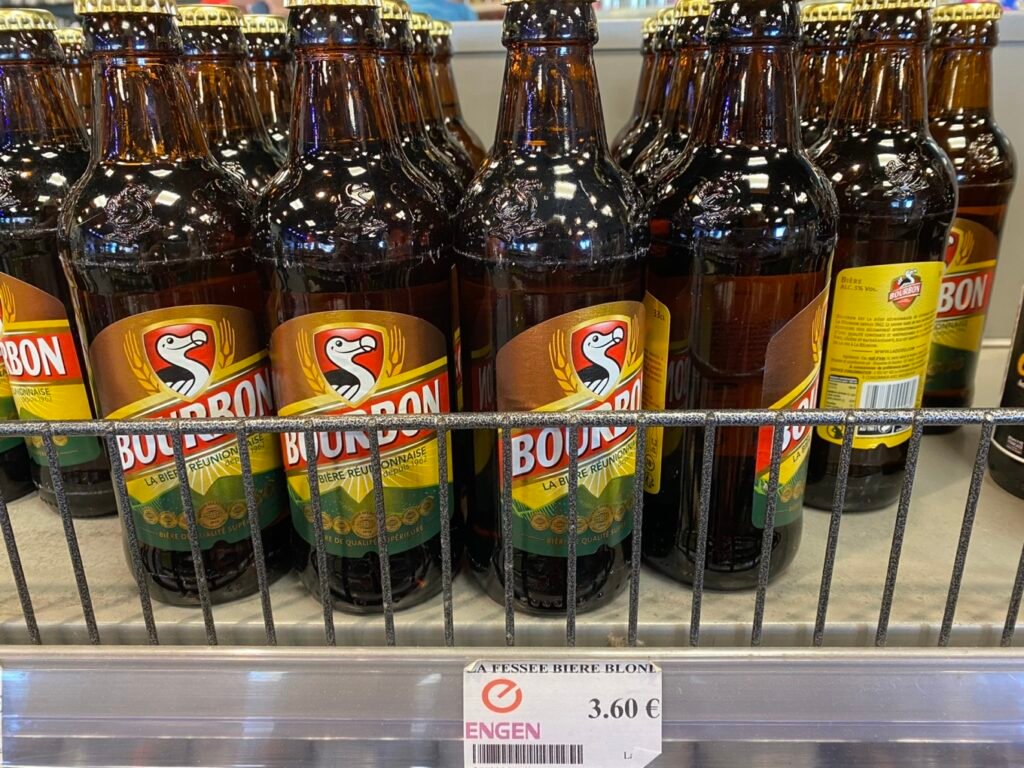
This is Réunion’s most famous beer, “Bourbon Beer,” which features the cute “dodo bird” on its label, so it’s often referred to as “Dodo Beer.”
Réunion boasts unique landscapes and natural resources. In 2010, UNESCO designated 40% of the island as a World Heritage Site, named “Volcanoes, Pitons, and Cirques,” which is a great acknowledgment of Réunion’s stunning mountain scenery and exceptional biodiversity. Other natural heritage sites recognized worldwide include the Galápagos Islands, the Great Barrier Reef, and the Grand Canyon National Park.
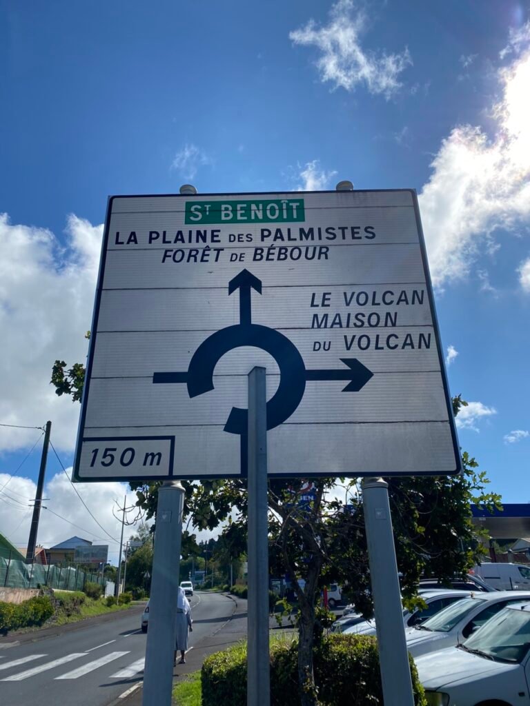
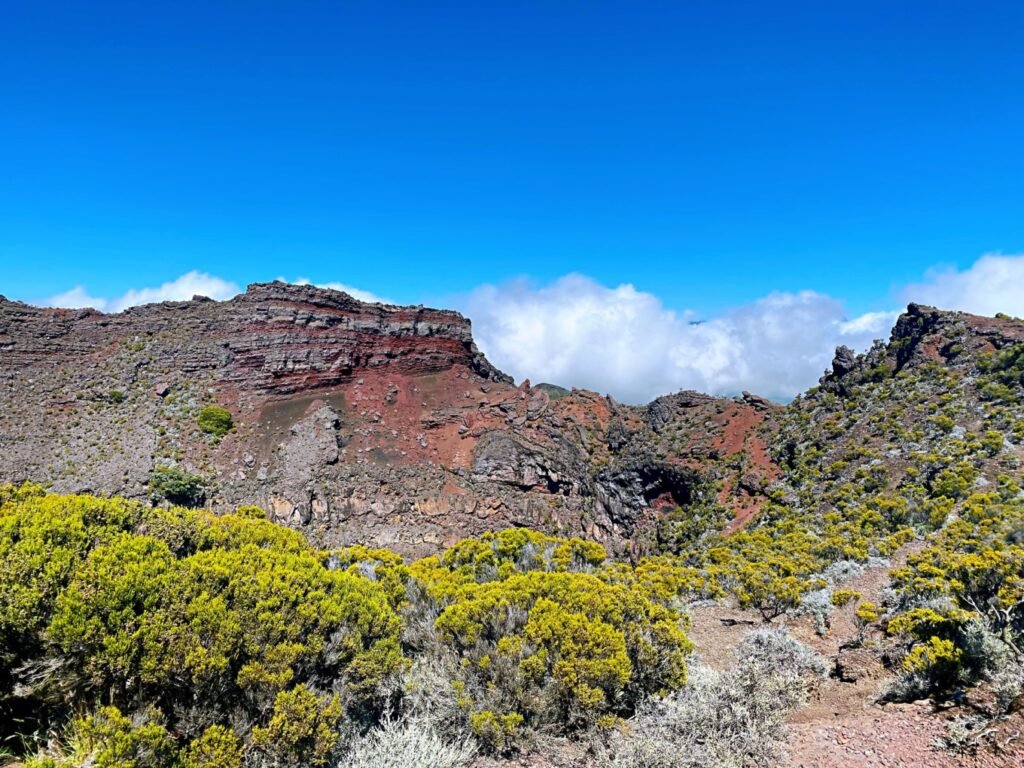
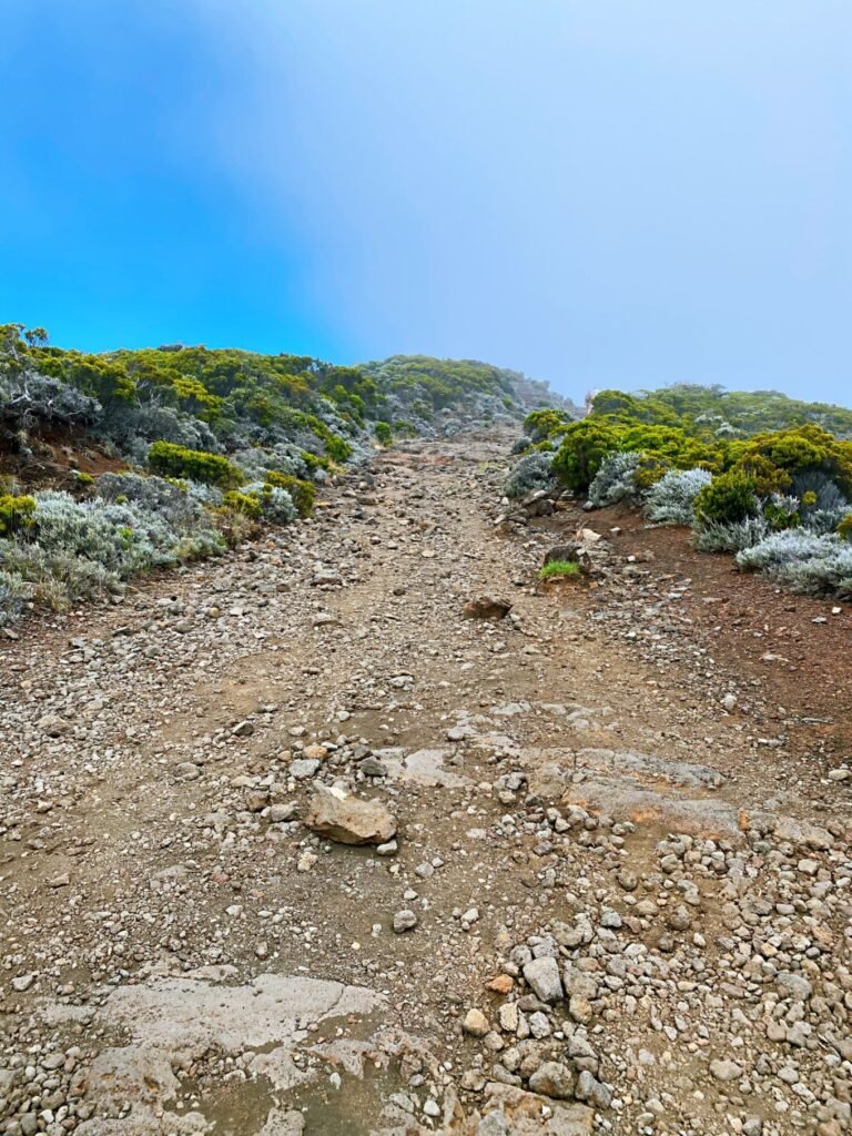
This is the road leading to the Piton de la Fournaise. Along the way, you’ll encounter many captivating views in various shapes and forms, making it worth your while to stop and take in the sights.
Featured Recommendation: Riviere des Remparts Valley
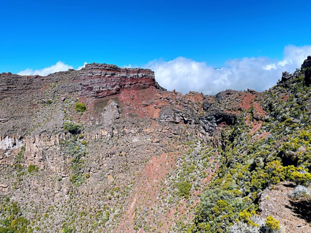
The Riviere des Remparts Valley offers breathtaking and unparalleled views. On your way to Piton de la Fournaise, be sure to stop at a viewpoint to take in the stunning scenery of the valley. The Belvedere du Nez-de-Boeuf is marked along the route.
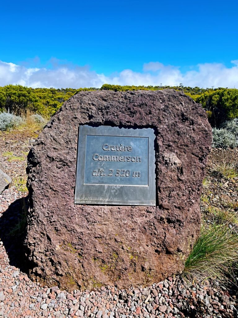
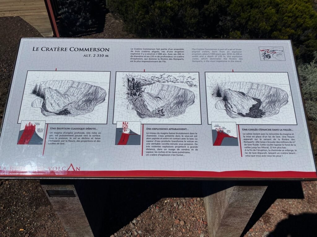
Commerson Crater
This crater is also on the way to the volcano, so keep an eye out for the signs. Standing at an elevation of 2,310 meters, the Commerson Crater was formed about 2,000 years ago during a volcanic eruption. It’s a massive pit, 200 meters wide and 235 meters deep.
There’s a viewpoint where I felt a bit shaky standing at the edge while taking photos. Our French guide mentioned that the crater’s depth and steep walls make it an excellent spot for local competitions, similar to rock climbing, where adventurers descend from the top and then climb back up from the bottom.
Along the way to the volcano, you’ll see various shrubs thriving in this volcanic landscape, bringing a touch of greenery to the vast, desolate land. Occasionally, you’ll spot resilient little flowers blooming brightly in the sunlight.
Practical Guide:
- Sun Protection: At elevations above 2,000 meters, the UV rays are intense, so make sure to apply sunscreen to avoid sunburn.
- Look for Signs: There will be markers for viewpoints along the way, so keep an eye out for them.
- Parking Safety: Parking is available near the viewpoints, but don’t stop on the roadside—it’s dangerous. The road to the volcano is winding.
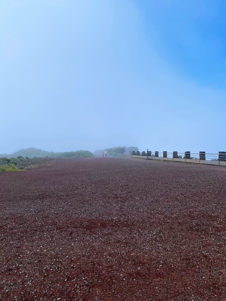
- Best Time to Go: Early morning is the ideal time to view the volcano and surrounding scenery, as you’re more likely to see clear views. Although my photos show blue skies and sunny weather, by the time we arrived at the Belvedere du Nez-de-Boeuf in the afternoon, fog had rolled in, and it started to rain.
- Bring Rain Gear: The weather can change rapidly, so having an umbrella or rain jacket is essential.
- Wear Sturdy Shoes: You’ll need comfortable, durable footwear for navigating the rocky trails and viewpoints, as the paths can be tricky.
- Pack Snacks and Water: Bring energy-boosting snacks and plenty of water to stay hydrated on your journey.
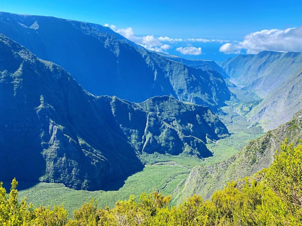
The Riviere des Remparts valley offers breathtaking and magnificent scenery.

On the way to Piton de la Fournaise, the vegetation along the roadside gradually changes…


Cratère Commerson
Cratère Commerson is a massive deep crater.

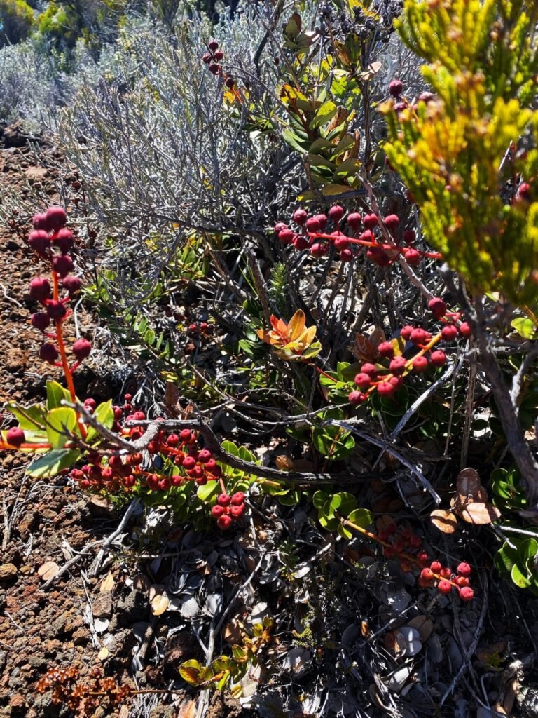
Our French guide said that these red fruits are toxic.

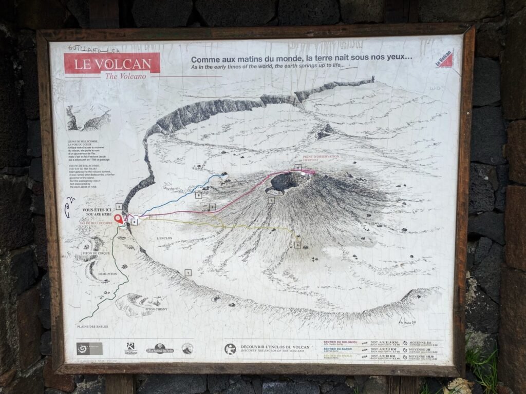
Furnaces Volcano is the top must-see spot in Réunion. It’s also one of the most accessible volcanoes in the world. As a signature landmark of Réunion, Furnaces Volcano is a must-visit for hikers. Starting from the Belcombe Pass, you can walk to the viewpoint on the northeastern side of the Dolomieu Crater—known as the Balcon du Dolomieu—where you can overlook the approximately 350-meter-deep crater floor. Of course, you can choose from various hiking routes based on your own preferences and fitness level, as there are multiple options available.


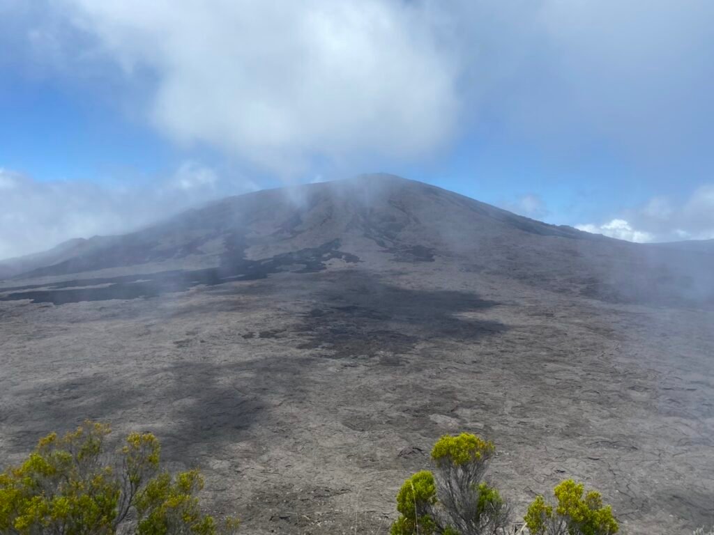
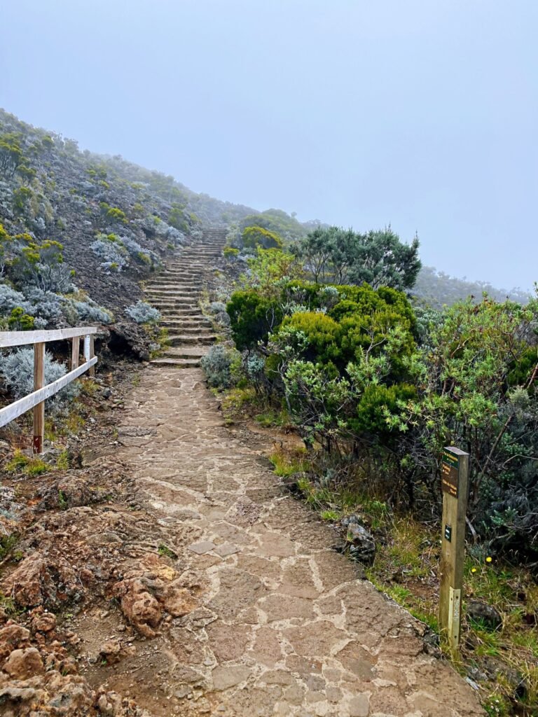
From the viewpoint at Belcombe Pass, you can enjoy a stunning view of the volcano.

From Belcombe Pass, you can see the distant Formica Lio volcanic cinder cone.

The path from Belcombe Pass to the volcano entrance is lined with dirt roads like this.
Volcano monitoring
No need to worry about volcanic eruptions. Scientists closely monitor the volcano’s activity and will issue warnings if any abnormalities are detected. As soon as signs of an eruption appear, roads leading to and around the volcano will be closed. In the photo, there’s a detector, but I’m not sure if it’s for monitoring weather conditions or the volcano itself. There are many of these detectors scattered across the lava fields.

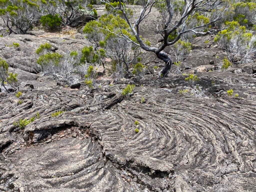
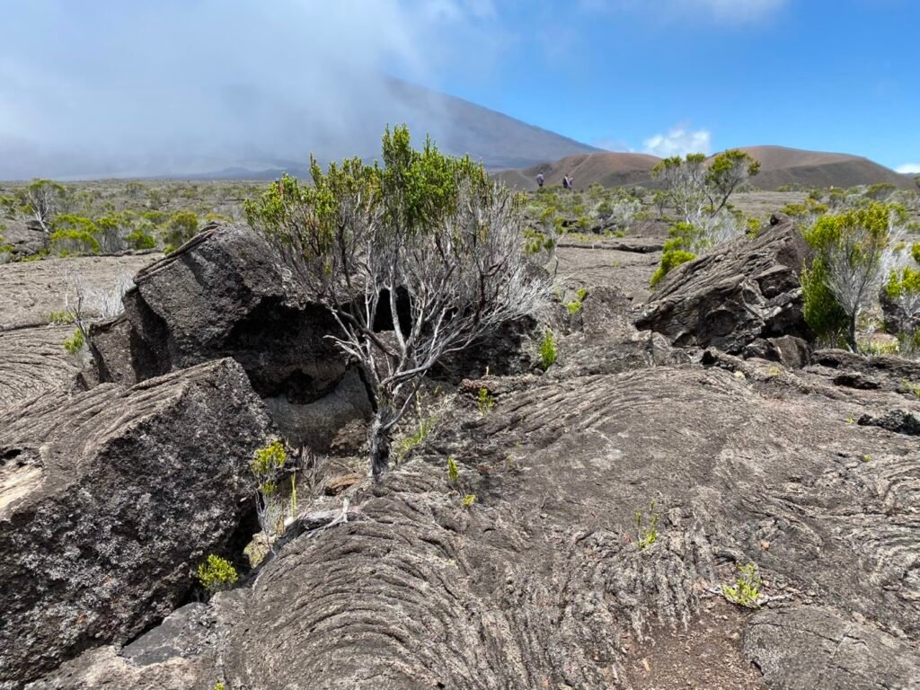
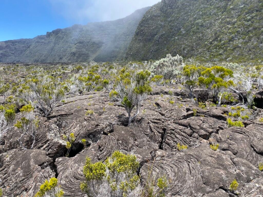
Walking on a field of solidified volcanic lava.
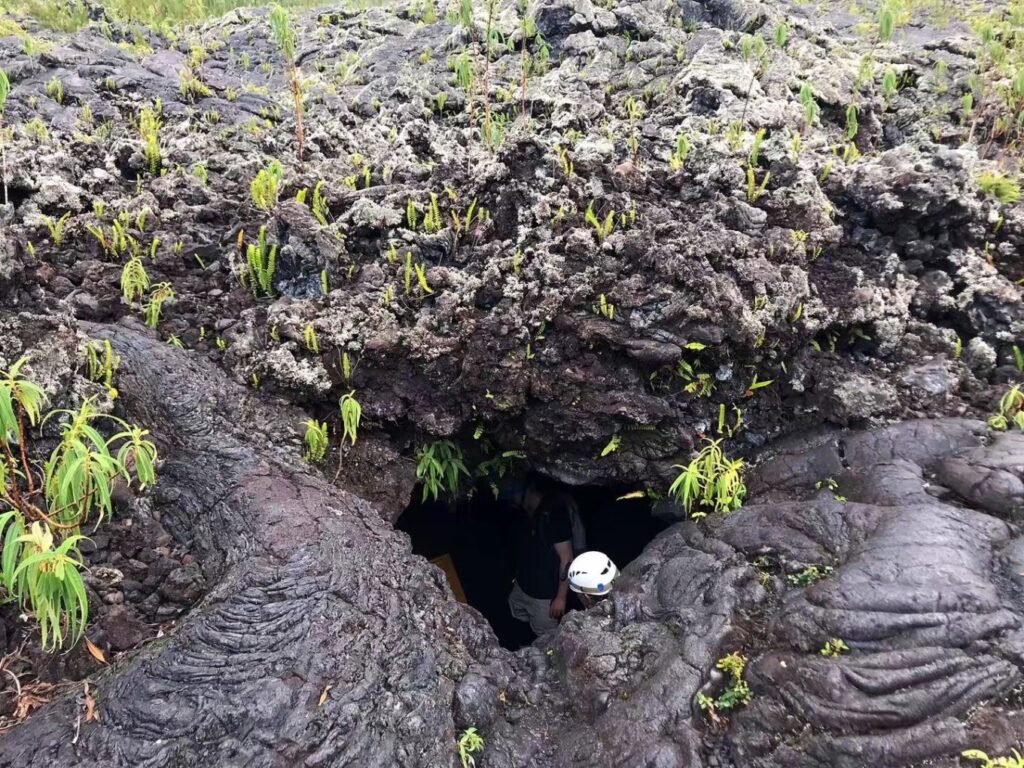
Lava Tunnel Experience – Absolutely Amazing
Address: Ice tunnels de lave de la coulee
Initially, this was the activity I was least excited about, but it turned out to be one of the must-try experiences on the island. The lava tunnel, from its formation to the continuous changes it undergoes, showcases the wonders of nature. Learning about its various components and the phenomena it has experienced leaves you in awe.
After experiencing the overwhelming sensation of absolute darkness, it gives you a newfound respect for the power and beauty of nature.

After exploring the lava tunnel, our plan was to head north around the island to Saint Gilles, passing by the Notre Dame des Laves.
Notre Dame des Laves is a church with a remarkable history. In 1977, when the Fournaise volcano erupted, lava engulfed the nearby village. However, upon reaching the church, the lava miraculously split and flowed around both sides of the building, only to merge again beyond it.

Hiking the Cirque de Cilaos
A cirque is essentially the result of volcanic eruptions followed by the gradual sinking of the earth’s surface. Over time, peaks are eroded and weathered, forming a concave, funnel-shaped landscape.
In my opinion, Route 14 is quite ordinary. The distance isn’t long, making it easy to complete. It also offers some flexibility—if you want to hike further, you can continue toward the Mafate Cirque.
If I have the chance to return, I’ll definitely plan a multi-day trek. Since the three cirques are interconnected, continuous trekking would allow me to avoid retracing my steps.
At 7:30, we left the hotel and followed the main road through the village, passing by a church. We kept following the navigation until we saw the landmark shown in the picture, marking the entrance to Route 14 and the trail to the Mafate Cirque.
The scenery along the way was truly stunning. Since there are no supply stations, it’s essential to carry enough water and snacks. Trekking poles are recommended, especially if, like me, you prefer using them when descending.
Each of us carried 1.5 liters of water, which I found more than sufficient—just for reference. I also packed some baguettes, biscuits, and candy. Keep in mind that hiking on the shaded side can be very cold, so bring a jacket. On the sunny side, however, it gets quite hot, so it’s important to dress in layers and manage your warmth.