While planning the itinerary, I carefully considered the options and decided to include a stop in Te Anau. It’s only about 118 kilometers from Milford Sound, making a round trip manageable without being too exhausting. Although Queenstown is geographically closer to the fjord, the mountain ranges force the road to take a long detour through Te Anau, resulting in a journey of over 300 kilometers one way. That much driving in one day would be quite tiring. While Lake Te Anau itself isn’t particularly stunning, the Airbnb we booked here turned out to be the most impressive accommodation of the entire trip.
Te Anau is a small resort town located next to the Fiordland National Park, which borders the Tasman Sea to the west. The park is home to numerous lakes, with Te Anau situated on the southern and eastern shores of Lake Te Anau—the largest lake on the South Island and the second-largest in New Zealand, covering an area of 344 square kilometers. It has a depth of 276 meters and sits at an elevation of 210 meters. While Te Anau serves as a key stop on the way to Milford Sound, many visitors still opt to stay in Queenstown, which makes Te Anau relatively quiet and peaceful.
South of Lake Te Anau lies another scenic spot: Lake Manapouri in the town of Manapouri, just a 20-minute drive away. Formed by glacial activity, Lake Manapouri reaches a depth of 444 meters, making it New Zealand’s deepest lake. It spans 142 square kilometers, ranking as the fifth-largest lake in the country. This glacial dammed lake sits at an elevation of 185 meters and offers breathtaking views, access to the Doubtful Sound, numerous islands, and several hiking trails. Like Te Anau, Manapouri is also a lesser-known destination, offering tranquility and beauty away from the crowds.
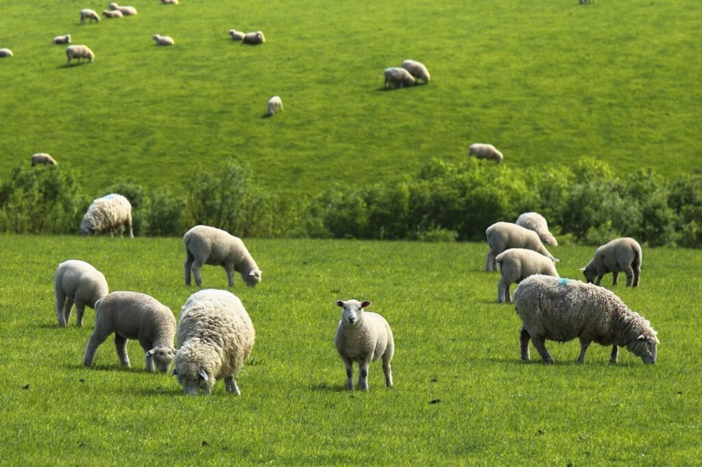
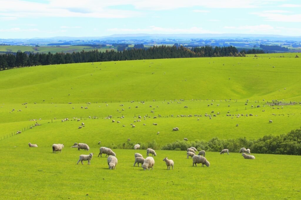
After leaving the town of Brighton, we headed south along Highway 1. Turning west into the interior, we joined Highway 94, passing through vast grasslands dotted with countless sheep. In New Zealand, sheep far outnumber the people.
Balfour Town
Around 1 p.m., we arrived at the tiny town of Balfour along Highway 94. The streets were almost deserted at midday. We had a quick lunch with some pizza we had brought along and didn’t stay long before continuing our journey.
Despite being a very small town, there was a remarkably clean public restroom along Queen Street.
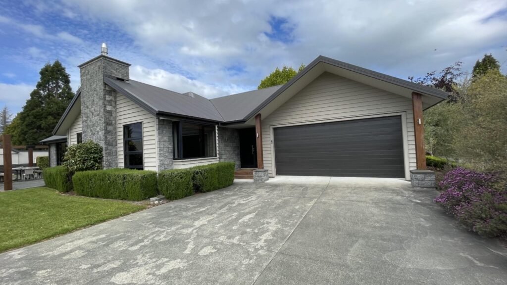
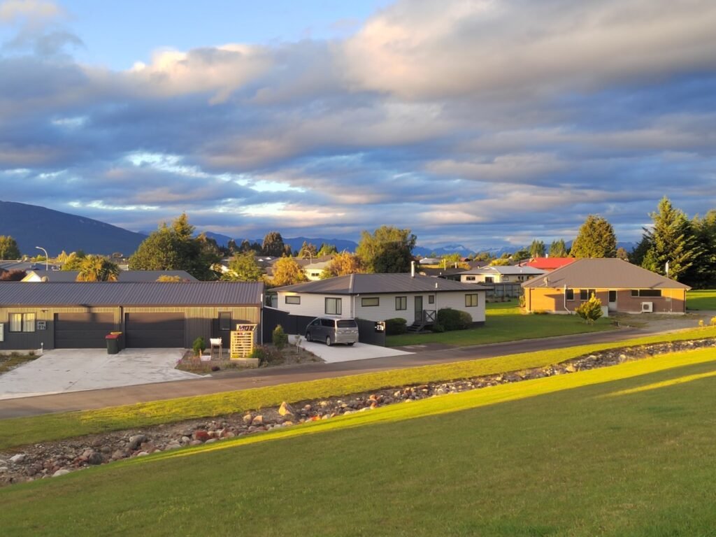
Te Anau House
We arrived in Te Anau around 2 p.m. and checked into a fantastic house on Dalhousie Place. It was the best accommodation of our South Island trip. The house features two master bedrooms with en-suite bathrooms, both with sliding doors that open directly to the backyard, and one twin bedroom.
It also includes a spacious garage with laundry facilities, enough to park two cars. The garage has an electric roller door for external access, and a separate door connects the garage to the house and garden. Inside the garage, there is a washing machine and a small fridge. The kitchen is fully equipped, with a walk-in pantry.
The entire house is clean, tidy, bright, and modern, offering a total interior area of over 200 square meters, with an additional 90-square-meter garage and a 450-square-meter garden. The rental price is about $300 per night, including taxes. It’s a great value, especially for two or three families traveling together, comfortably accommodating 4 to 6 people while sharing the cost.

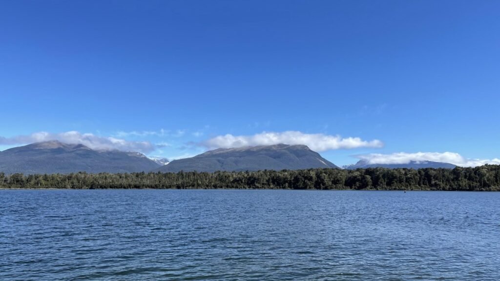
Lake Te Anau
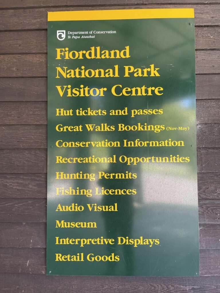
After settling in, we made the most of our time by heading to Lake Te Anau, New Zealand’s second-largest lake and the largest on the South Island. It is also the largest glacial lake in the Southern Hemisphere, with tourism centered around its scenic waters.
Covering an area of 344 square kilometers, Lake Te Anau reaches a depth of 276 meters, with an elevation of 210 meters above sea level.
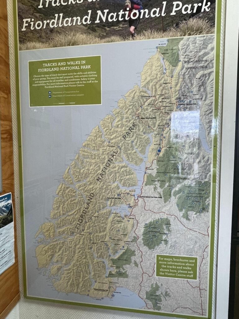
At the visitor center, we found a tourist map showing the hiking trails and roads connecting Lake Te Anau with Lake Manapouri. The map highlighted many accommodation options along the way. A note in the bottom right corner explained that maps and brochures are available at the visitor center. In the upper left corner, there were reminders about the difficulty of some trails, advising visitors to choose routes based on their abilities, bring appropriate clothing, and be mindful of the weather and safety.
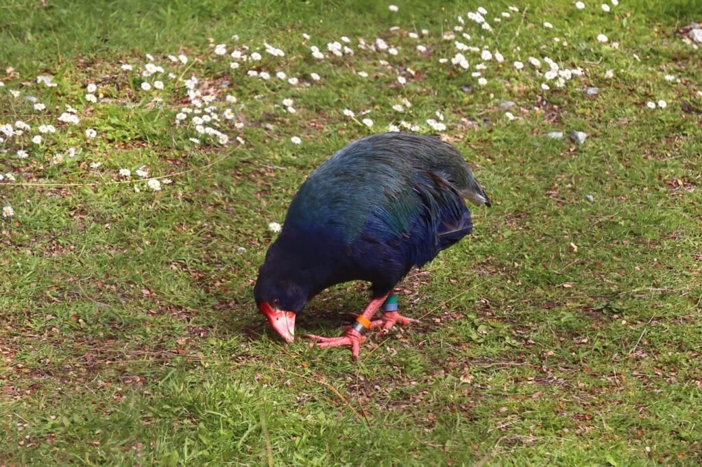
Te Anau Bird Sanctuary: Takahe
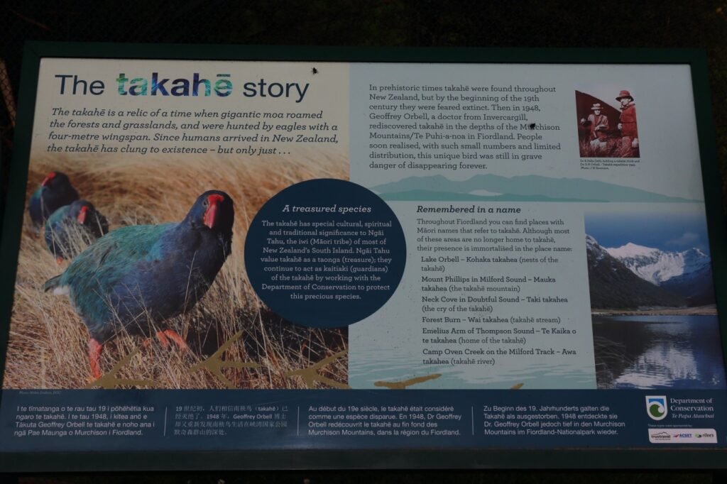
The takahe is a flightless bird native to New Zealand, known for its vibrant colors. It has blue-green feathers, a large, thick red beak that extends to the forehead, and red ankles. The takahe feeds on grass seeds and was once hunted heavily by the Māori for its tender meat, nearly driving it to extinction. In 2013, there were about 200 individuals left, but by 2019, the population had recovered to 418 birds.
Despite its chicken-like appearance, the takahe is a unique, flightless bird. Scientists believe that millions of years ago, the species flew over from Australia and spread across both the North and South Islands of New Zealand. Like many other large birds in Oceania, the takahe’s feathers degenerated over time, rendering it flightless. However, with no large native predators, the takahe thrived, with its population once reaching over 80 million.
The arrival of the Māori around 1,000 years ago dramatically changed the fate of the takahe. The bird’s inability to fly made it an easy target, and its tender meat quickly became a staple of the Māori diet. By the 19th century, when Europeans arrived, the takahe had nearly disappeared. The introduction of mammals, such as grazing animals competing for food, further threatened the species, pushing it to the brink of extinction.
The takahe has existed in New Zealand since prehistoric times but was thought to be extinct by the early 19th century. However, on November 20, 1948, amateur naturalist Dr. Geoffrey Orbell from Invercargill rediscovered the species deep in the Murchison Mountains of Fiordland.
It quickly became evident that with such a small population, the unique takahe was still at great risk of extinction. In response, the New Zealand government closed off this remote area to prevent further human interference.
For Ngāi Tahu, the principal Māori tribe of the South Island, the takahe holds significant cultural, spiritual, and traditional value. They regard the bird as a treasure and actively collaborate with New Zealand’s conservation agencies to protect this rare species.
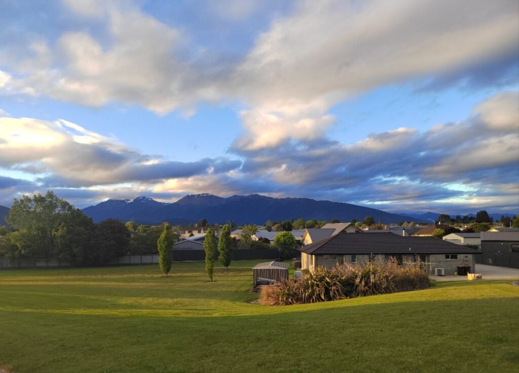
Strolling northeast along Dalhousie Place, we found ourselves in an unbelievably quiet town, with only a few of us walking along the streets. The soft glow of the setting sun gently illuminated the houses and lawns, while the blue sky, adorned with both white clouds and darker shades of overcast, resembled a stunning ink painting. In the distance, the deep hues of the Southern Alps and the faintly visible snow-capped peaks added to the breathtaking interplay of light and color, creating a scene of exquisite beauty.
Henry Creek Campsite
We stopped for about 20 minutes at Henry Creek Campsite, located by the lakeside in the Middle Fiord area, to take photos and enjoy the scenery.
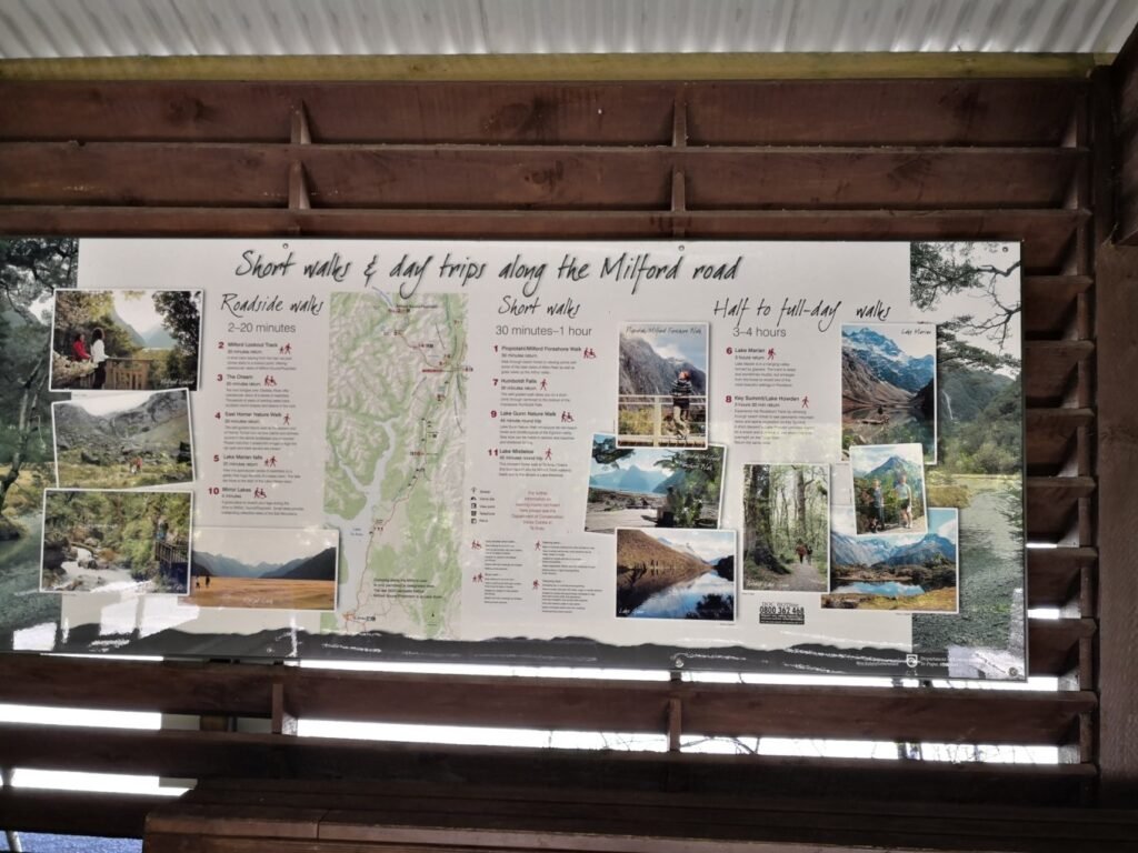
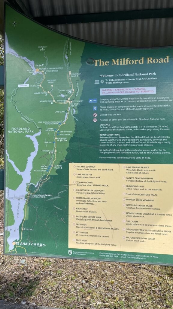
The Milford Road from Lake Te Anau to Milford Sound is well-documented with a detailed guide map, highlighting viewpoints, accommodation, campsites, trails, valleys, rivers, waterfalls, streams, lakes, information centers, restrooms, and natural features like the Homer Tunnel. It also shows sections of several famous trails, including the Milford Track, Greenstone Track, Routeburn Track, Key Summit, and Hollyford Track. Both the Milford and Routeburn Tracks are particularly renowned, so it’s worth studying the map to plan which sights to visit. However, if you’re doing a round trip in one day, hiking the tracks may not be feasible.
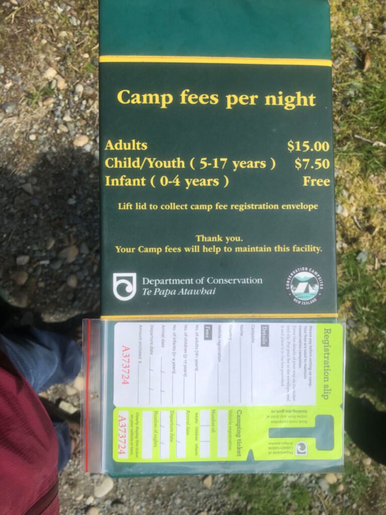
Camping along the route requires a fee. You’ll need to fill out a form printed by New Zealand’s Department of Conservation (DOC), enclose the form along with the payment, and drop it into a designated box. From what I understand, the fee likely contributes to restroom use, facility maintenance, and emergency services. The area is quite remote, with no staff present, so everything relies on an honor system.
Te Anau Downs
Highway 94 takes a 90-degree turn at Boat Harbour, leading to the Te Anau Downs Scenic Lookout. The boat launch here likely serves as a boarding point for seaplanes, yachts, and tour boats. From this point, you can take a boat to Glade Wharf at the northernmost end of Lake Te Anau. Glade Wharf marks the starting point of the Milford Track, one of New Zealand’s nine Great Walks. Access to the Milford Track requires advance booking, and entry is not permitted without a reservation.
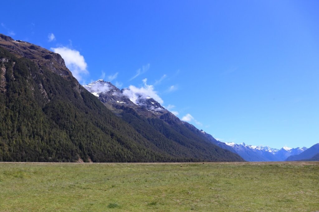
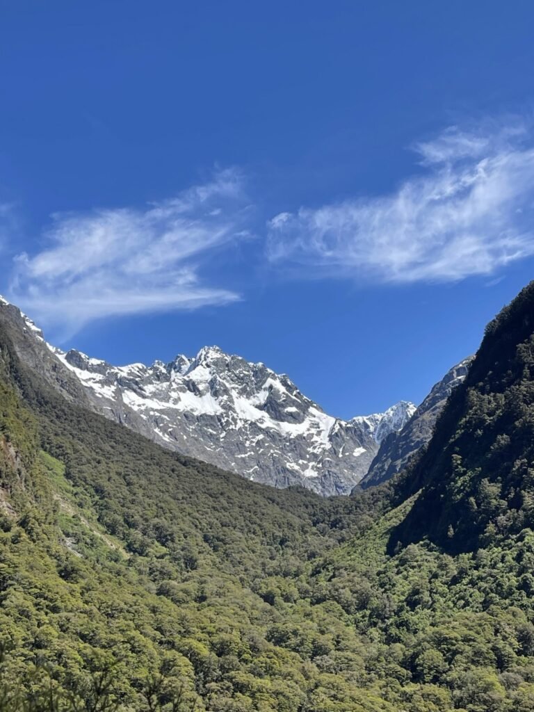
Eglinton Valley
Mt Eglinton, with a peak elevation of over 1,800 meters, is covered by glaciers and flanked by steep slopes. The Eglinton Valley itself is flat and, at its widest point, spans 2 kilometers. It is one of the few places in New Zealand with extensive lowland beech forests. Both Mt Eglinton and the Eglinton River were named after the 13th Earl of Eglinton, a British Conservative politician.
The Divide
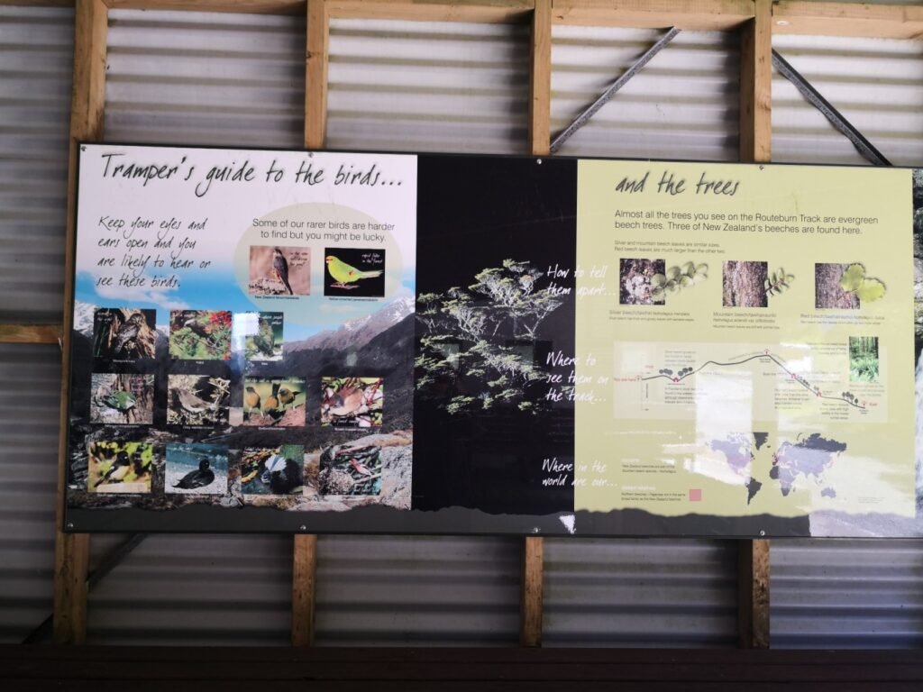
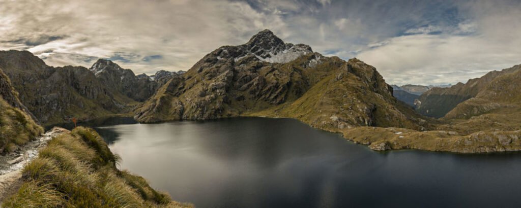
The Divide is the lowest east-west pass in the entire Southern Alps, with an elevation of about 530 meters. It is located near the renowned Routeburn Track, which ranks second among New Zealand’s nine Great Walks. In May 2005, National Geographic Adventure magazine listed it as one of the world’s 11 most classic hiking routes.
The Routeburn Track stretches 32 kilometers, starting at The Divide on Highway 94 in the west and ending at the Routeburn Shelter near Glenorchy in the east. A short side trail from The Divide leads to the Key Summit Trail, a popular short hike that loops back to the Routeburn Track. As a top-tier Great Walk, the Routeburn Track comes with some challenges and typically takes 2 to 4 days to complete, with overnight stays at huts maintained by New Zealand’s Department of Conservation (DOC).
The highest point of the trail reaches 1,255 meters and offers breathtaking views of towering peaks and deep valleys. Along the way, hikers will encounter spectacular sights, including the majestic Earland Falls, with a drop of 174 meters, Lake Mackenzie, and the shimmering waters of Lake Harris, which range from vibrant blue to silver-gray.
Lake Harris, featured in photos on New Zealand’s tourism website, lies amidst the Darren Range. Across the Hollyford River to the northwest are the towering Mount Madeline at 2,537 meters and Mount Tutoko, the highest peak in the area, standing at 2,746 meters.
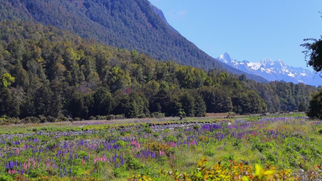
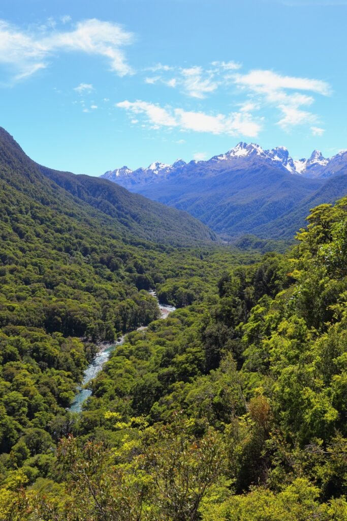
Hollyford Valley
Hollyford Valley begins where Highway 94, traveling north, turns westward to cross the Southern Alps. Nearby, the Pop’s View Lookout offers an excellent vantage point to admire the valley, though you’ll need to leave Highway 94 and drive about 100 to 200 meters to reach the parking area.
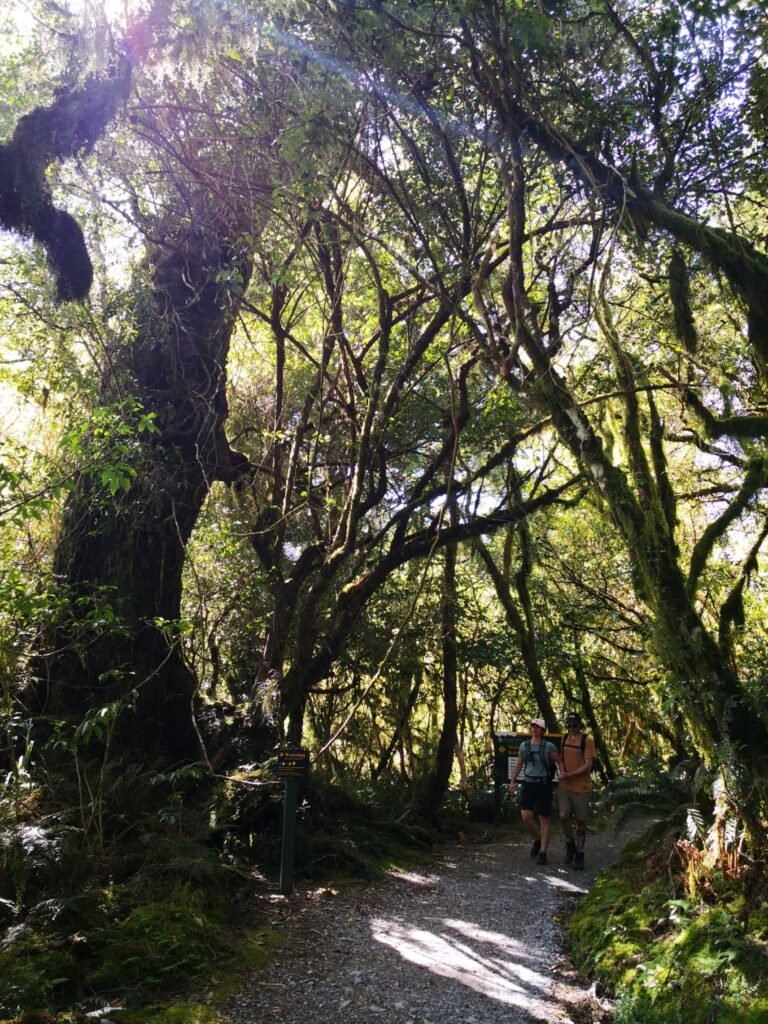
Also in the area is the Lake Marian Track, a short trail that takes around three to four hours for a round trip. While the trail is generally considered low difficulty, one section features a nearly 90-degree steep slope, making it a bit challenging. Along the way, the scenery is stunning, with light blue rivers and roaring waterfalls. The trail is quiet and uncrowded, creating a peaceful and refreshing hiking experience.
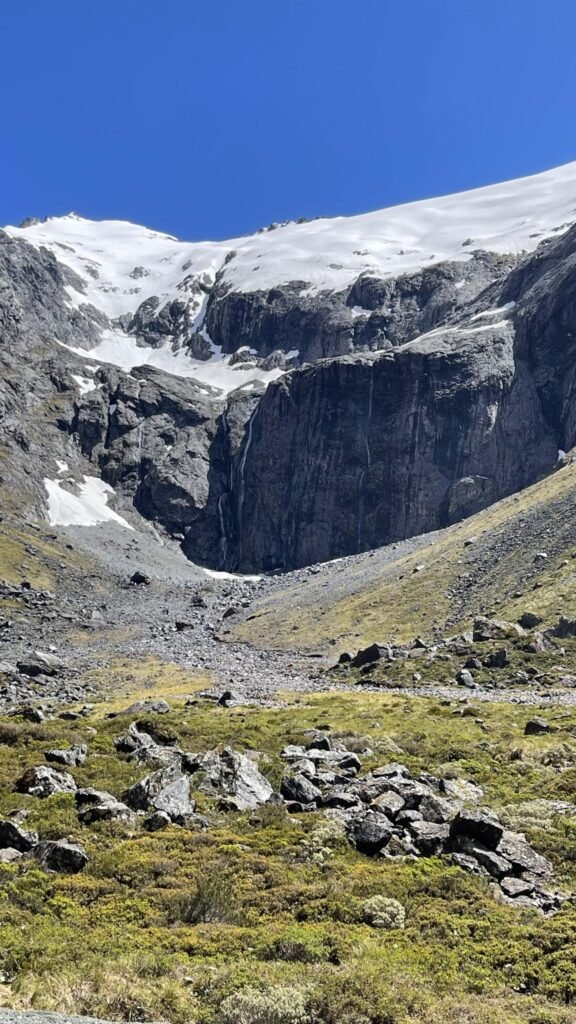
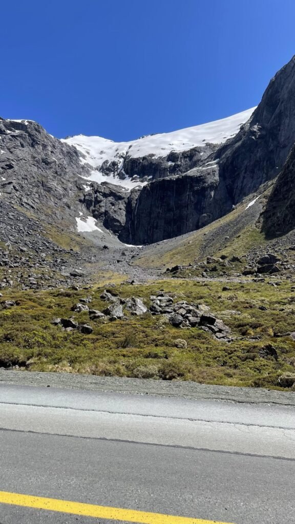
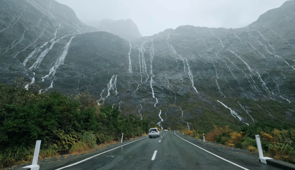
Homer Tunnel
Just after 12 p.m., we arrived at the Homer Tunnel, with only about 19 kilometers left to reach Milford Sound. Construction of the tunnel began in 1935, but delays occurred due to World War II and an avalanche. It was finally completed and opened to traffic in 1954.
The tunnel is 1,270 meters long, with an entrance elevation of 960 meters and an exit at over 800 meters. It is named after the person who proposed its construction.
The tunnel has two lanes, but during the busy tourist season, traffic becomes one-way for safety. Red and green lights are installed at both ends to control the flow, though the wait times are usually short. Driving through the tunnel is straightforward and manageable.
Milford Sound
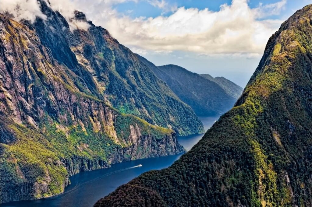
The Southern Alps run in a southwest-northeast direction across New Zealand’s South Island. The northern part of the range is known for its glaciers, with the highest peak being Mount Cook (Aoraki). In the southern part, the western slopes are steep, bordering the Tasman Sea. This jagged southwestern and western coastline forms 16 fjords, with a total fjord length along the coast reaching 44 kilometers.
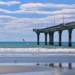
Milford Sound, also known as Milford Fjord, is the largest and most famous of these fjords, located at the northernmost end of Highway 94. It is an example of glacial erosion, formed thousands of years ago when massive glaciers extended into the coast, carving U-shaped valleys through both downward and lateral erosion. After the glaciers melted, seawater flooded the valleys, creating the deep fjord. The waters are wide and deep, flanked by towering, steep mountains.
The coastline in this fjord region is winding and extensive. Globally, over 80% of fjords are found in Europe, primarily in Northern Europe, with most located along Norway’s Scandinavian Peninsula.
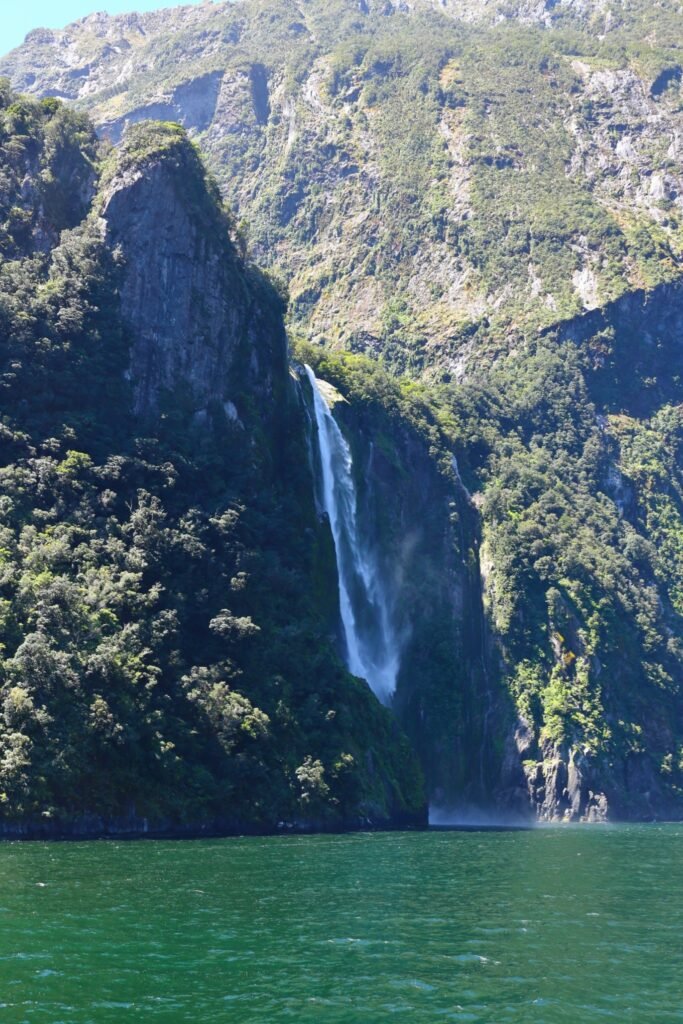
Fairy Falls
Fairy Falls cascades down a concave section of the mountainside. Tour boats approach the base of the waterfall, getting remarkably close. With a drop of 155 meters, it is the second-largest waterfall in Milford Sound. The immense mist, combined with the thunderous roar of the falling water, creates an awe-inspiring and unforgettable experience.
Routeburn Track Starting Point
On the way back, we passed the starting point of the Routeburn Track, New Zealand’s second-ranked Great Walk. A relatively large visitor center at the trailhead offers useful information and guidelines. The Routeburn Track is challenging and typically takes three days to complete, ending near Glenorchy. Along the way, hikers stay in basic huts managed by the Department of Conservation (DOC).
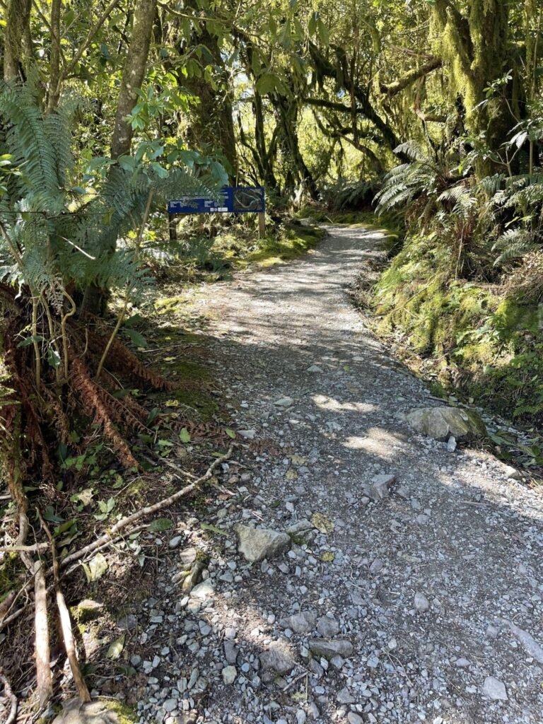
The trail consists of gravel paths, so it’s important not to expect well-paved concrete roads or stone steps. The Routeburn Track offers a more natural, untouched hiking experience, staying true to New Zealand’s wilderness.